El Niño
El Niño is a term people often associate with heavier rains and storms here in America. But what really is El Niño—where does it come from and what does it mean for us?
First off, it is important to understand that the ocean and the atmosphere are closely linked together:
The sun heats the Earth differently across the globe → air temperature / pressure differences
Air wants to flow from high to low pressure (cold to warm)
Difference in the air pressures around the globe → winds
Winds → Ocean currents and generation of waves
In a typical year without El Niño, there are the Easterly trade winds at the equator that blow from the Eastern Pacific (near Central and South America) towards Asia and Australia. This results in a warmer body of water in the Western Pacific, and a low-pressure system which is why Indonesia often gets a LOT of rain. If you hear ‘low pressure system’ in the atmosphere, think rain.
Cold, nutrient rich water from the deep ocean comes to the surface to replace the warm surface water being pushed offshore near the Americas. This is called “upwelling” and is the reason fisheries are typically so productive along the west coast of South America. Cold, nutrient rich water coming up increases the primary productivity in the ocean. A highly productive ocean with lots of food for fish is what fisheries depend on.
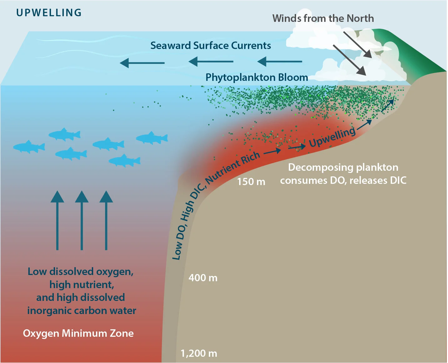
Image from: Francis Chan, John A. Barth, Kristy J. Kroeker, Jane Lubchenco and Bruce A. Menge. Modified from Gewin (2010) by Moni Kovacs.
But roughly every 3-8 years, there is an anomalous change in air pressure in the atmosphere—and the Easterly trade winds die down and switch direction. The warm water in the Western Pacific (near Indonesia and Australia) starts to move back to the Eastern Pacific. The warm water pool moving towards the coast of the Americas, results in a low-pressure system and is why increased rainfall is predicted there during El Nino years.
Unfortunately for fisheries along the west coast of the Americas, this warm water mass moving in shuts down upwelling—the upbringing of cold, nutrient rich waters needed for productivity—which means less fish food on our coasts…which means less fish. Fisheries get hit hard. It has been said that Peruvian fisherman were the first to classify the arrival of these unusually warm waters and dramatic climate fluctuations as El Niño, for ‘Christ Child.’
Since the atmosphere and ocean are so tightly coupled, El Niño has global impacts and we often see droughts and floods become more extreme in various places during these events.
Despite what you may have heard, El Nino isn’t a big storm or simply an occurrence of heavy rainfall. It is not guaranteed to result in big waves, and stormy weather in California. It is the result of a change in atmospheric winds causing warm water from the Western Pacific to flow towards the Eastern Pacific.
Every El Niño year is a little different and it is incredibly difficult (even with the best climate models) to predict what will happen—so we might see increased precipitation along the West Coast and droughts in Indonesia and Australia, but it is impossible to say exactly what weather and oceanic conditions we can expect in an El Niño year. It is truly an anomaly.
Cheers,
AT
Further reading:
https://www.noaa.gov/resource-collections/el-nino
https://www.nationalgeographic.org/encyclopedia/el-nino/